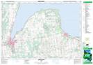
Maps showing Presqu'ile Point, Grey, Ontario
Presqu'ile Point is a Cape located in Grey, Ontario and has an elevation of 178 meters.
- Latitude: 44° 41' 48'' North (decimal: 44.6966666)
- Longitude: 80° 54' 27'' West (decimal: -80.9074999)
- Topography Feature Category: Cape
- Geographical Feature: Point
- Canadian Province/Territory: Ontario
- Elevation: 178 meters
- Location: Grey
- Atlas of Canada Locator Map: Presqu'ile Point
- GPS Coordinate Locator Map: Presqu'ile Point Lat/Long
Presqu'ile Point NTS Map Sheets