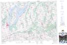
Maps showing Prince Albert, Ontario, Ontario
Prince Albert is a Unincorporated area located in Ontario, Ontario and has an elevation of 276 meters.
- Latitude: 44° 5' 10'' North (decimal: 44.0861111)
- Longitude: 78° 57' 11'' West (decimal: -78.9530555)
- Topography Feature Category: Unincorporated area
- Geographical Feature: Compact Rural Community
- Canadian Province/Territory: Ontario
- Elevation: 276 meters
- Location: Ontario
- Atlas of Canada Locator Map: Prince Albert
- GPS Coordinate Locator Map: Prince Albert Lat/Long