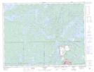
Maps showing Profile Point, Rainy River, Ontario
Profile Point is a Cape located in Rainy River, Ontario and has an elevation of 396 meters.
- Latitude: 48° 45' 57'' North (decimal: 48.7658333)
- Longitude: 91° 42' 15'' West (decimal: -91.7041666)
- Topography Feature Category: Cape
- Geographical Feature: Point
- Canadian Province/Territory: Ontario
- Elevation: 396 meters
- Location: Rainy River
- Atlas of Canada Locator Map: Profile Point
- GPS Coordinate Locator Map: Profile Point Lat/Long