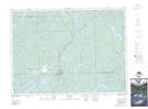
Maps showing Rabbit Chute, Nipissing, Ontario
Rabbit Chute is a Falls located in Nipissing, Ontario and has an elevation of 295 meters.
- Latitude: 47° 2' 33'' North (decimal: 47.0424999)
- Longitude: 79° 34' 54'' West (decimal: -79.5816666)
- Topography Feature Category: Falls
- Geographical Feature: Chute
- Canadian Province/Territory: Ontario
- Elevation: 295 meters
- Location: Nipissing
- Atlas of Canada Locator Map: Rabbit Chute
- GPS Coordinate Locator Map: Rabbit Chute Lat/Long
Rabbit Chute NTS Map Sheets