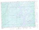
Maps showing Rabbit Island, Algoma, Ontario
Rabbit Island is a Island located in Algoma, Ontario and has an elevation of 342 meters.
- Latitude: 48° 18' 1'' North (decimal: 48.3002777)
- Longitude: 84° 8' 41'' West (decimal: -84.1447222)
- Topography Feature Category: Island
- Geographical Feature: Island
- Canadian Province/Territory: Ontario
- Elevation: 342 meters
- Location: Algoma
- Atlas of Canada Locator Map: Rabbit Island
- GPS Coordinate Locator Map: Rabbit Island Lat/Long