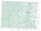
Maps showing Rabbit Mountain, Thunder Bay, Ontario
Rabbit Mountain is a Mountain located in Thunder Bay, Ontario.
- Latitude: 48° 18' 38'' North (decimal: 48.3105555)
- Longitude: 89° 38' 10'' West (decimal: -89.6361111)
- Topography Feature Category: Mountain
- Geographical Feature: Mountain
- Canadian Province/Territory: Ontario
- Location: Thunder Bay
- Atlas of Canada Locator Map: Rabbit Mountain
- GPS Coordinate Locator Map: Rabbit Mountain Lat/Long
Rabbit Mountain NTS Map Sheets