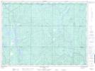
Maps showing Shoepack Lake, Sudbury, Ontario
Shoepack Lake is a Lake located in Sudbury, Ontario.
- Latitude: 47° 28' 35'' North (decimal: 47.4763888)
- Longitude: 81° 15' 10'' West (decimal: -81.2527777)
- Topography Feature Category: Lake
- Geographical Feature: Lake
- Canadian Province/Territory: Ontario
- Location: Sudbury
- Atlas of Canada Locator Map: Shoepack Lake
- GPS Coordinate Locator Map: Shoepack Lake Lat/Long
Shoepack Lake NTS Map Sheets