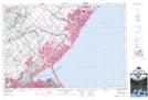
Maps showing Randle Reef, Wentworth, Ontario
Randle Reef is a Shoal located in Wentworth, Ontario.
- Latitude: 43° 16' 30'' North (decimal: 43.2749999)
- Longitude: 79° 50' 4'' West (decimal: -79.8344444)
- Topography Feature Category: Shoal
- Geographical Feature: Reef
- Canadian Province/Territory: Ontario
- Location: Wentworth
- Atlas of Canada Locator Map: Randle Reef
- GPS Coordinate Locator Map: Randle Reef Lat/Long
Randle Reef NTS Map Sheets