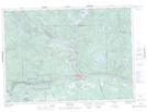
Maps showing Rankin, Nipissing, Ontario
Rankin is a Unincorporated area located in Nipissing, Ontario and has an elevation of 166 meters.
- Latitude: 46° 18' 45'' North (decimal: 46.3124999)
- Longitude: 78° 34' 35'' West (decimal: -78.5763888)
- Topography Feature Category: Unincorporated area
- Geographical Feature: Dispersed Rural Community
- Canadian Province/Territory: Ontario
- Elevation: 166 meters
- Location: Nipissing
- Atlas of Canada Locator Map: Rankin
- GPS Coordinate Locator Map: Rankin Lat/Long