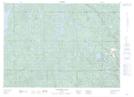
Maps showing Reed Lake, Sudbury, Ontario
Reed Lake is a Lake located in Sudbury, Ontario and has an elevation of 424 meters.
- Latitude: 46° 50' 58'' North (decimal: 46.8494444)
- Longitude: 81° 11' 9'' West (decimal: -81.1858333)
- Topography Feature Category: Lake
- Geographical Feature: Lake
- Canadian Province/Territory: Ontario
- Elevation: 424 meters
- Location: Sudbury
- Atlas of Canada Locator Map: Reed Lake
- GPS Coordinate Locator Map: Reed Lake Lat/Long
Reed Lake NTS Map Sheets