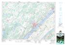
Maps showing Refugee Island, Leeds, Ontario
Refugee Island is a Island located in Leeds, Ontario and has an elevation of 75 meters.
- Latitude: 44° 34' 9'' North (decimal: 44.5691666)
- Longitude: 75° 41' 58'' West (decimal: -75.6994444)
- Topography Feature Category: Island
- Geographical Feature: Island
- Canadian Province/Territory: Ontario
- Elevation: 75 meters
- Location: Leeds
- Atlas of Canada Locator Map: Refugee Island
- GPS Coordinate Locator Map: Refugee Island Lat/Long
Refugee Island NTS Map Sheets