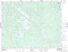
Maps showing Revell Lake, Kenora, Ontario
Revell Lake is a Lake located in Kenora, Ontario and has an elevation of 448 meters.
- Latitude: 49° 25' 50'' North (decimal: 49.4305555)
- Longitude: 92° 2' 31'' West (decimal: -92.0419444)
- Topography Feature Category: Lake
- Geographical Feature: Lake
- Canadian Province/Territory: Ontario
- Elevation: 448 meters
- Location: Kenora
- Atlas of Canada Locator Map: Revell Lake
- GPS Coordinate Locator Map: Revell Lake Lat/Long