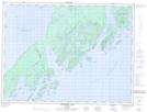
Maps showing Roche Debout Channel, Thunder Bay, Ontario
Roche Debout Channel is a Channel located in Thunder Bay, Ontario and has an elevation of 183 meters.
- Latitude: 48° 34' 47'' North (decimal: 48.5797222)
- Longitude: 88° 16' 55'' West (decimal: -88.2819444)
- Topography Feature Category: Channel
- Geographical Feature: Channel
- Canadian Province/Territory: Ontario
- Elevation: 183 meters
- Location: Thunder Bay
- Atlas of Canada Locator Map: Roche Debout Channel
- GPS Coordinate Locator Map: Roche Debout Channel Lat/Long
Roche Debout Channel NTS Map Sheets