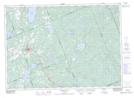
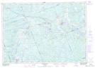
Maps showing Rock Island, Parry Sound, Ontario
Rock Island is a Island located in Parry Sound, Ontario and has an elevation of 328 meters.
- Latitude: 45° 40' 19'' North (decimal: 45.6719444)
- Longitude: 79° 30' 6'' West (decimal: -79.5016666)
- Topography Feature Category: Island
- Geographical Feature: Island
- Canadian Province/Territory: Ontario
- Elevation: 328 meters
- Location: Parry Sound
- Atlas of Canada Locator Map: Rock Island
- GPS Coordinate Locator Map: Rock Island Lat/Long
Rock Island NTS Map Sheets