Canada Topographic Maps

Rocksand River Topo Maps

Topography maps and Latitude/Longitude Location

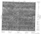
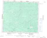
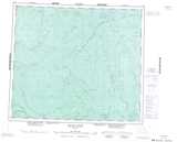
Maps showing Rocksand River, Kenora, Ontario

Rocksand River is a River located in Kenora, Ontario.

  • Latitude: 55° 8' 31'' North   (decimal: 55.1419444)
  • Longitude: 88° 27' 34'' West   (decimal: -88.4594444)
  • Topography Feature Category: River
  • Geographical Feature: River
  • Canadian Province/Territory: Ontario
  • Location: Kenora
  • Atlas of Canada Locator Map: Rocksand River
  • GPS Coordinate Locator Map: Rocksand River Lat/Long

Rocksand River NTS Map Sheets

053I10 No Title Topographic Map at 1:50,000 scale

053I15 No Title Topographic Map at 1:50,000 scale

053I16 No Title Topographic Map at 1:50,000 scale

053P01 No Title Topographic Map at 1:50,000 scale

053P02 Goose Island Topographic Map at 1:50,000 scale

053I Fawn River Topographic Map at 1:250,000 scale

053P Island River Topographic Map at 1:250,000 scale

 
Buy Topographic Maps DVD
Newsletter Sign-up

Yes, I want to receive map store discounts.


Bookmark and Share