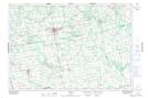
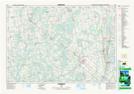
Maps showing Rocky Saugeen River, Grey, Ontario
Rocky Saugeen River is a River located in Grey, Ontario and has an elevation of 374 meters.
- Latitude: 44° 12' 20'' North (decimal: 44.2055555)
- Longitude: 80° 53' 10'' West (decimal: -80.8861111)
- Topography Feature Category: River
- Geographical Feature: River
- Canadian Province/Territory: Ontario
- Elevation: 374 meters
- Location: Grey
- Atlas of Canada Locator Map: Rocky Saugeen River
- GPS Coordinate Locator Map: Rocky Saugeen River Lat/Long
Rocky Saugeen River NTS Map Sheets