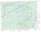
Maps showing Rolling Creek, Thunder Bay, Ontario
Rolling Creek is a River located in Thunder Bay, Ontario.
- Latitude: 48° 42' 11'' North (decimal: 48.7030555)
- Longitude: 90° 36' 49'' West (decimal: -90.6136111)
- Topography Feature Category: River
- Geographical Feature: Creek
- Canadian Province/Territory: Ontario
- Location: Thunder Bay
- Atlas of Canada Locator Map: Rolling Creek
- GPS Coordinate Locator Map: Rolling Creek Lat/Long
Rolling Creek NTS Map Sheets