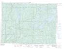
Maps showing Root, Algoma, Ontario
Root is a Geographical area located in Algoma, Ontario.
- Latitude: 46° 56' 00'' North (decimal: 46.9333333)
- Longitude: 83° 8' 49'' West (decimal: -83.1469444)
- Topography Feature Category: Geographical area
- Geographical Feature: Geographic Township
- Canadian Province/Territory: Ontario
- Location: Algoma
- Atlas of Canada Locator Map: Root
- GPS Coordinate Locator Map: Root Lat/Long
Root NTS Map Sheets