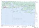
Maps showing Rainboth Island, Algoma, Ontario
Rainboth Island is a Island located in Algoma, Ontario and has an elevation of 177 meters.
- Latitude: 46° 8' 24'' North (decimal: 46.1400000)
- Longitude: 82° 30' 47'' West (decimal: -82.5130555)
- Topography Feature Category: Island
- Geographical Feature: Island
- Canadian Province/Territory: Ontario
- Elevation: 177 meters
- Location: Algoma
- Atlas of Canada Locator Map: Rainboth Island
- GPS Coordinate Locator Map: Rainboth Island Lat/Long