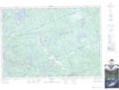
Maps showing Round Island, Parry Sound, Ontario
Round Island is a Island located in Parry Sound, Ontario and has an elevation of 207 meters.
- Latitude: 45° 15' 59'' North (decimal: 45.2663888)
- Longitude: 79° 58' 20'' West (decimal: -79.9722222)
- Topography Feature Category: Island
- Geographical Feature: Island
- Canadian Province/Territory: Ontario
- Elevation: 207 meters
- Location: Parry Sound
- Atlas of Canada Locator Map: Round Island
- GPS Coordinate Locator Map: Round Island Lat/Long
Round Island NTS Map Sheets