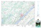
Maps showing Rows Corners, Leeds, Ontario
Rows Corners is a Unincorporated area located in Leeds, Ontario and has an elevation of 104 meters.
- Latitude: 44° 37' 59'' North (decimal: 44.6330555)
- Longitude: 75° 41' 33'' West (decimal: -75.6925000)
- Topography Feature Category: Unincorporated area
- Geographical Feature: Compact Rural Community
- Canadian Province/Territory: Ontario
- Elevation: 104 meters
- Location: Leeds
- Atlas of Canada Locator Map: Rows Corners
- GPS Coordinate Locator Map: Rows Corners Lat/Long
Rows Corners NTS Map Sheets