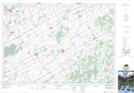
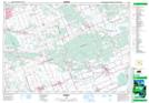
Maps showing United Counties of Prescott and Russell, Russell; Prescott, Ontario
United Counties of Prescott and Russell is a Major municipal/district area - major agglomeration located in Russell; Prescott, Ontario.
- Latitude: 45° 25' 3'' North (decimal: 45.4175000)
- Longitude: 75° 15' 4'' West (decimal: -75.2511111)
- Topography Feature Category: Major municipal/district area - major agglomeration
- Geographical Feature: County Municipality
- Canadian Province/Territory: Ontario
- Location: Russell; Prescott
- Atlas of Canada Locator Map: United Counties of Prescott and Russell
- GPS Coordinate Locator Map: United Counties of Prescott and Russell Lat/Long
United Counties of Prescott and Russell NTS Map Sheets