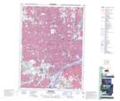
Maps showing Sandwich, Essex, Ontario
Sandwich is a Unincorporated area located in Essex, Ontario and has an elevation of 182 meters.
- Latitude: 42° 16' 59'' North (decimal: 42.2830555)
- Longitude: 83° 3' 34'' West (decimal: -83.0594444)
- Topography Feature Category: Unincorporated area
- Geographical Feature: Urban Community
- Canadian Province/Territory: Ontario
- Elevation: 182 meters
- Location: Essex
- Atlas of Canada Locator Map: Sandwich
- GPS Coordinate Locator Map: Sandwich Lat/Long