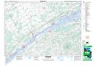
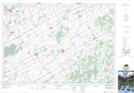
Maps showing Shaver-Harper Municipal Drain, Dundas, Ontario
Shaver-Harper Municipal Drain is a Hydraulic construction located in Dundas, Ontario and has an elevation of 79 meters.
- Latitude: 44° 58' 11'' North (decimal: 44.9697222)
- Longitude: 75° 28' 23'' West (decimal: -75.4730555)
- Topography Feature Category: Hydraulic construction
- Geographical Feature: Drain
- Canadian Province/Territory: Ontario
- Elevation: 79 meters
- Location: Dundas
- Atlas of Canada Locator Map: Shaver-Harper Municipal Drain
- GPS Coordinate Locator Map: Shaver-Harper Municipal Drain Lat/Long
Shaver-Harper Municipal Drain NTS Map Sheets