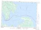
Maps showing Shepherd Reef, Algoma, Ontario
Shepherd Reef is a Shoal located in Algoma, Ontario.
- Latitude: 46° 10' 1'' North (decimal: 46.1669444)
- Longitude: 83° 34' 59'' West (decimal: -83.5830555)
- Topography Feature Category: Shoal
- Geographical Feature: Reef
- Canadian Province/Territory: Ontario
- Location: Algoma
- Atlas of Canada Locator Map: Shepherd Reef
- GPS Coordinate Locator Map: Shepherd Reef Lat/Long
Shepherd Reef NTS Map Sheets