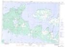
Maps showing Sheshegwaning, Manitoulin, Ontario
Sheshegwaning is a Unincorporated area located in Manitoulin, Ontario and has an elevation of 189 meters.
- Latitude: 45° 56' 18'' North (decimal: 45.9383333)
- Longitude: 82° 50' 26'' West (decimal: -82.8405555)
- Topography Feature Category: Unincorporated area
- Geographical Feature: Dispersed Rural Community
- Canadian Province/Territory: Ontario
- Elevation: 189 meters
- Location: Manitoulin
- Atlas of Canada Locator Map: Sheshegwaning
- GPS Coordinate Locator Map: Sheshegwaning Lat/Long
Sheshegwaning NTS Map Sheets