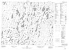
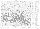
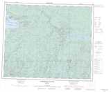
Maps showing Shibogama Lake, Kenora, Ontario
Shibogama Lake is a Lake located in Kenora, Ontario and has an elevation of 183 meters.
- Latitude: 53° 34' 25'' North (decimal: 53.5736111)
- Longitude: 88° 11' 8'' West (decimal: -88.1855555)
- Topography Feature Category: Lake
- Geographical Feature: Lake
- Canadian Province/Territory: Ontario
- Elevation: 183 meters
- Location: Kenora
- Atlas of Canada Locator Map: Shibogama Lake
- GPS Coordinate Locator Map: Shibogama Lake Lat/Long
Shibogama Lake NTS Map Sheets