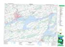
Maps showing Ship Islet, Prince Edward, Ontario
Ship Islet is a Island located in Prince Edward, Ontario.
- Latitude: 44° 8' 30'' North (decimal: 44.1416666)
- Longitude: 77° 17' 39'' West (decimal: -77.2941666)
- Topography Feature Category: Island
- Geographical Feature: Island
- Canadian Province/Territory: Ontario
- Location: Prince Edward
- Atlas of Canada Locator Map: Ship Islet
- GPS Coordinate Locator Map: Ship Islet Lat/Long
Ship Islet NTS Map Sheets