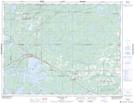
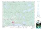
Maps showing Shoshowae Creek, Kenora, Ontario
Shoshowae Creek is a River located in Kenora, Ontario and has an elevation of 360 meters.
- Latitude: 49° 49' 52'' North (decimal: 49.8311111)
- Longitude: 92° 56' 3'' West (decimal: -92.9341666)
- Topography Feature Category: River
- Geographical Feature: Creek
- Canadian Province/Territory: Ontario
- Elevation: 360 meters
- Location: Kenora
- Atlas of Canada Locator Map: Shoshowae Creek
- GPS Coordinate Locator Map: Shoshowae Creek Lat/Long
Shoshowae Creek NTS Map Sheets