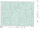
Maps showing Shuller Lake, Sudbury, Ontario
Shuller Lake is a Lake located in Sudbury, Ontario and has an elevation of 370 meters.
- Latitude: 47° 36' 33'' North (decimal: 47.6091666)
- Longitude: 81° 37' 6'' West (decimal: -81.6183333)
- Topography Feature Category: Lake
- Geographical Feature: Lake
- Canadian Province/Territory: Ontario
- Elevation: 370 meters
- Location: Sudbury
- Atlas of Canada Locator Map: Shuller Lake
- GPS Coordinate Locator Map: Shuller Lake Lat/Long