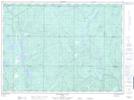
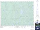
Maps showing Silvester Creek, Sudbury, Ontario
Silvester Creek is a River located in Sudbury, Ontario and has an elevation of 371 meters.
- Latitude: 47° 17' 13'' North (decimal: 47.2869444)
- Longitude: 81° 1' 16'' West (decimal: -81.0211111)
- Topography Feature Category: River
- Geographical Feature: Creek
- Canadian Province/Territory: Ontario
- Elevation: 371 meters
- Location: Sudbury
- Atlas of Canada Locator Map: Silvester Creek
- GPS Coordinate Locator Map: Silvester Creek Lat/Long
Silvester Creek NTS Map Sheets