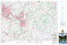
Maps showing Sink-Hole Swamp, Brant; Waterloo, Ontario
Sink-Hole Swamp is a Low vegetation located in Brant; Waterloo, Ontario and has an elevation of 301 meters.
- Latitude: 43° 16' 51'' North (decimal: 43.2808333)
- Longitude: 80° 23' 31'' West (decimal: -80.3919444)
- Topography Feature Category: Low vegetation
- Geographical Feature: Swamp
- Canadian Province/Territory: Ontario
- Elevation: 301 meters
- Location: Brant; Waterloo
- Atlas of Canada Locator Map: Sink-Hole Swamp
- GPS Coordinate Locator Map: Sink-Hole Swamp Lat/Long
Sink-Hole Swamp NTS Map Sheets