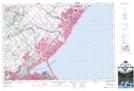
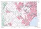
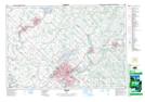
Maps showing Sixteen Mile Creek, Halton, Ontario
Sixteen Mile Creek is a River located in Halton, Ontario and has an elevation of 318 meters.
- Latitude: 43° 26' 22'' North (decimal: 43.4394444)
- Longitude: 79° 39' 57'' West (decimal: -79.6658333)
- Topography Feature Category: River
- Geographical Feature: Creek
- Canadian Province/Territory: Ontario
- Elevation: 318 meters
- Location: Halton
- Atlas of Canada Locator Map: Sixteen Mile Creek
- GPS Coordinate Locator Map: Sixteen Mile Creek Lat/Long
Sixteen Mile Creek NTS Map Sheets