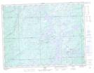
Maps showing Sixty One Bay, Algoma, Ontario
Sixty One Bay is a Bay located in Algoma, Ontario and has an elevation of 336 meters.
- Latitude: 48° 19' 25'' North (decimal: 48.3236111)
- Longitude: 84° 6' 30'' West (decimal: -84.1083333)
- Topography Feature Category: Bay
- Geographical Feature: Bay
- Canadian Province/Territory: Ontario
- Elevation: 336 meters
- Location: Algoma
- Atlas of Canada Locator Map: Sixty One Bay
- GPS Coordinate Locator Map: Sixty One Bay Lat/Long