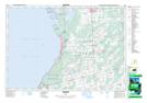
Maps showing Skinner's Marsh, Grey, Ontario
Skinner's Marsh is a Low vegetation located in Grey, Ontario and has an elevation of 240 meters.
- Latitude: 44° 38' 31'' North (decimal: 44.6419444)
- Longitude: 81° 6' 8'' West (decimal: -81.1022222)
- Topography Feature Category: Low vegetation
- Geographical Feature: Marsh
- Canadian Province/Territory: Ontario
- Elevation: 240 meters
- Location: Grey
- Atlas of Canada Locator Map: Skinner's Marsh
- GPS Coordinate Locator Map: Skinner's Marsh Lat/Long