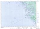
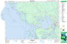
Maps showing Skunk Island, Parry Sound, Ontario
Skunk Island is a Island located in Parry Sound, Ontario and has an elevation of 177 meters.
- Latitude: 45° 15' 00'' North (decimal: 45.2499999)
- Longitude: 80° 12' 59'' West (decimal: -80.2163888)
- Topography Feature Category: Island
- Geographical Feature: Island
- Canadian Province/Territory: Ontario
- Elevation: 177 meters
- Location: Parry Sound
- Atlas of Canada Locator Map: Skunk Island
- GPS Coordinate Locator Map: Skunk Island Lat/Long
Skunk Island NTS Map Sheets