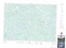
Maps showing Slate Falls, Renfrew, Ontario
Slate Falls is a Falls located in Renfrew, Ontario and has an elevation of 266 meters.
- Latitude: 45° 14' 9'' North (decimal: 45.2358333)
- Longitude: 77° 16' 26'' West (decimal: -77.2738888)
- Topography Feature Category: Falls
- Geographical Feature: Falls
- Canadian Province/Territory: Ontario
- Elevation: 266 meters
- Location: Renfrew
- Atlas of Canada Locator Map: Slate Falls
- GPS Coordinate Locator Map: Slate Falls Lat/Long