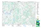
Maps showing Smiths Falls, Leeds; Lanark, Ontario
Smiths Falls is a Town located in Leeds; Lanark, Ontario and has an elevation of 123 meters.
- Latitude: 44° 54' 4'' North (decimal: 44.9011111)
- Longitude: 76° 1' 10'' West (decimal: -76.0194444)
- Topography Feature Category: Town
- Geographical Feature: Separated Town
- Canadian Province/Territory: Ontario
- Elevation: 123 meters
- Location: Leeds; Lanark
- Atlas of Canada Locator Map: Smiths Falls
- GPS Coordinate Locator Map: Smiths Falls Lat/Long
Smiths Falls NTS Map Sheets