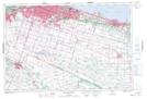
Maps showing Smithville, Lincoln, Ontario
Smithville is a Unincorporated area located in Lincoln, Ontario and has an elevation of 182 meters.
- Latitude: 43° 5' 50'' North (decimal: 43.0972222)
- Longitude: 79° 32' 47'' West (decimal: -79.5463888)
- Topography Feature Category: Unincorporated area
- Geographical Feature: Compact Rural Community
- Canadian Province/Territory: Ontario
- Elevation: 182 meters
- Location: Lincoln
- Atlas of Canada Locator Map: Smithville
- GPS Coordinate Locator Map: Smithville Lat/Long
Smithville NTS Map Sheets