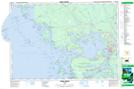
Maps showing Snug Haven, Parry Sound, Ontario
Snug Haven is a Unincorporated area located in Parry Sound, Ontario and has an elevation of 181 meters.
- Latitude: 45° 22' 23'' North (decimal: 45.3730555)
- Longitude: 80° 18' 8'' West (decimal: -80.3022222)
- Topography Feature Category: Unincorporated area
- Geographical Feature: Dispersed Rural Community
- Canadian Province/Territory: Ontario
- Elevation: 181 meters
- Location: Parry Sound
- Atlas of Canada Locator Map: Snug Haven
- GPS Coordinate Locator Map: Snug Haven Lat/Long
Snug Haven NTS Map Sheets