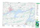
Maps showing Solmes Island, Prince Edward, Ontario
Solmes Island is a Island located in Prince Edward, Ontario.
- Latitude: 44° 10' North (decimal: 44.1667000)
- Longitude: 77° 7' West (decimal: -77.1166999)
- Topography Feature Category: Island
- Geographical Feature: Island
- Canadian Province/Territory: Ontario
- Location: Prince Edward
- GPS Coordinate Locator Map: Solmes Island Lat/Long
Solmes Island NTS Map Sheets