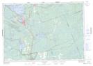
Maps showing Sopher's Landing, Muskoka, Ontario
Sopher's Landing is a Unincorporated area located in Muskoka, Ontario and has an elevation of 213 meters.
- Latitude: 44° 50' 46'' North (decimal: 44.8461111)
- Longitude: 79° 23' 59'' West (decimal: -79.3997222)
- Topography Feature Category: Unincorporated area
- Geographical Feature: Dispersed Rural Community
- Canadian Province/Territory: Ontario
- Elevation: 213 meters
- Location: Muskoka
- Atlas of Canada Locator Map: Sopher's Landing
- GPS Coordinate Locator Map: Sopher's Landing Lat/Long
Sopher's Landing NTS Map Sheets