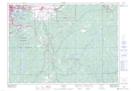
Maps showing Southeast Baby Lake, Sudbury, Ontario
Southeast Baby Lake is a Lake located in Sudbury, Ontario and has an elevation of 253 meters.
- Latitude: 46° 23' 42'' North (decimal: 46.3950000)
- Longitude: 80° 45' 59'' West (decimal: -80.7663888)
- Topography Feature Category: Lake
- Geographical Feature: Lake
- Canadian Province/Territory: Ontario
- Elevation: 253 meters
- Location: Sudbury
- Atlas of Canada Locator Map: Southeast Baby Lake
- GPS Coordinate Locator Map: Southeast Baby Lake Lat/Long