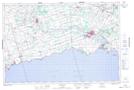
Maps showing South Forks Drain, Welland, Ontario
South Forks Drain is a Hydraulic construction located in Welland, Ontario and has an elevation of 176 meters.
- Latitude: 42° 57' 11'' North (decimal: 42.9530555)
- Longitude: 79° 28' 7'' West (decimal: -79.4686111)
- Topography Feature Category: Hydraulic construction
- Geographical Feature: Drain
- Canadian Province/Territory: Ontario
- Elevation: 176 meters
- Location: Welland
- Atlas of Canada Locator Map: South Forks Drain
- GPS Coordinate Locator Map: South Forks Drain Lat/Long
South Forks Drain NTS Map Sheets