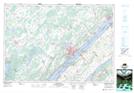
Maps showing Sparrow Island, Leeds, Ontario
Sparrow Island is a Island located in Leeds, Ontario.
- Latitude: 44° 33' 22'' North (decimal: 44.5561111)
- Longitude: 75° 43' 3'' West (decimal: -75.7175000)
- Topography Feature Category: Island
- Geographical Feature: Island
- Canadian Province/Territory: Ontario
- Location: Leeds
- Atlas of Canada Locator Map: Sparrow Island
- GPS Coordinate Locator Map: Sparrow Island Lat/Long
Sparrow Island NTS Map Sheets