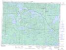
Maps showing Splint Lake, Sudbury, Ontario
Splint Lake is a Lake located in Sudbury, Ontario and has an elevation of 466 meters.
- Latitude: 47° 53' 15'' North (decimal: 47.8874999)
- Longitude: 83° 38' 11'' West (decimal: -83.6363888)
- Topography Feature Category: Lake
- Geographical Feature: Lake
- Canadian Province/Territory: Ontario
- Elevation: 466 meters
- Location: Sudbury
- Atlas of Canada Locator Map: Splint Lake
- GPS Coordinate Locator Map: Splint Lake Lat/Long