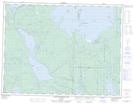
Maps showing Split Rapids, Thunder Bay, Ontario
Split Rapids is a Rapids located in Thunder Bay, Ontario and has an elevation of 262 meters.
- Latitude: 49° 16' 59'' North (decimal: 49.2830555)
- Longitude: 88° 46' 30'' West (decimal: -88.7749999)
- Topography Feature Category: Rapids
- Geographical Feature: Rapids
- Canadian Province/Territory: Ontario
- Elevation: 262 meters
- Location: Thunder Bay
- Atlas of Canada Locator Map: Split Rapids
- GPS Coordinate Locator Map: Split Rapids Lat/Long
Split Rapids NTS Map Sheets