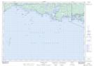
Maps showing Squaw Island Bank, Manitoulin, Ontario
Squaw Island Bank is a Shoal located in Manitoulin, Ontario.
- Latitude: 45° 47' 1'' North (decimal: 45.7836000)
- Longitude: 81° 26' 28'' West (decimal: -81.4411000)
- Topography Feature Category: Shoal
- Geographical Feature: Bank
- Canadian Province/Territory: Ontario
- Location: Manitoulin
- GPS Coordinate Locator Map: Squaw Island Bank Lat/Long
Squaw Island Bank NTS Map Sheets