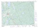
Maps showing Squirrel Island, Parry Sound, Ontario
Squirrel Island is a Island located in Parry Sound, Ontario and has an elevation of 383 meters.
- Latitude: 45° 32' 22'' North (decimal: 45.5394444)
- Longitude: 79° 10' 57'' West (decimal: -79.1824999)
- Topography Feature Category: Island
- Geographical Feature: Island
- Canadian Province/Territory: Ontario
- Elevation: 383 meters
- Location: Parry Sound
- Atlas of Canada Locator Map: Squirrel Island
- GPS Coordinate Locator Map: Squirrel Island Lat/Long
Squirrel Island NTS Map Sheets