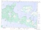
Maps showing Stafford Rock, Manitoulin, Ontario
Stafford Rock is a Shoal located in Manitoulin, Ontario.
- Latitude: 45° 47' 53'' North (decimal: 45.7980555)
- Longitude: 82° 58' 29'' West (decimal: -82.9747222)
- Topography Feature Category: Shoal
- Geographical Feature: Rock
- Canadian Province/Territory: Ontario
- Location: Manitoulin
- Atlas of Canada Locator Map: Stafford Rock
- GPS Coordinate Locator Map: Stafford Rock Lat/Long
Stafford Rock NTS Map Sheets